A cover crop paper can report a yield gain, a yield loss, or no change, and all three can be sound. What separates them is often the place: the soil, the rainfall, and the length of the season the trial ran under. A reader deciding whether a result applies to their ground needs to know where it was measured. That detail usually sits in the methods section, where a title search will not find it.
OpenAgData keeps the place with the paper. It is an index of agricultural research organized by where the work was done, who did it, and who paid for it, with measured results kept beside their sources. OpenAgData is one of the platforms the Soil Health Exchange team is building, for researchers, advisers, and the organizations that fund and run research.
The six screens below show the public site as it stood on November 14, 2026, with no account signed in. The numbered notes under each screen point to what to read first.
Start with a topic, then look at the map
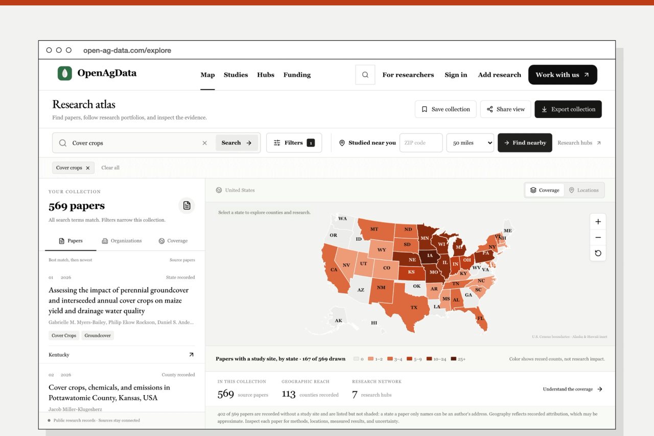
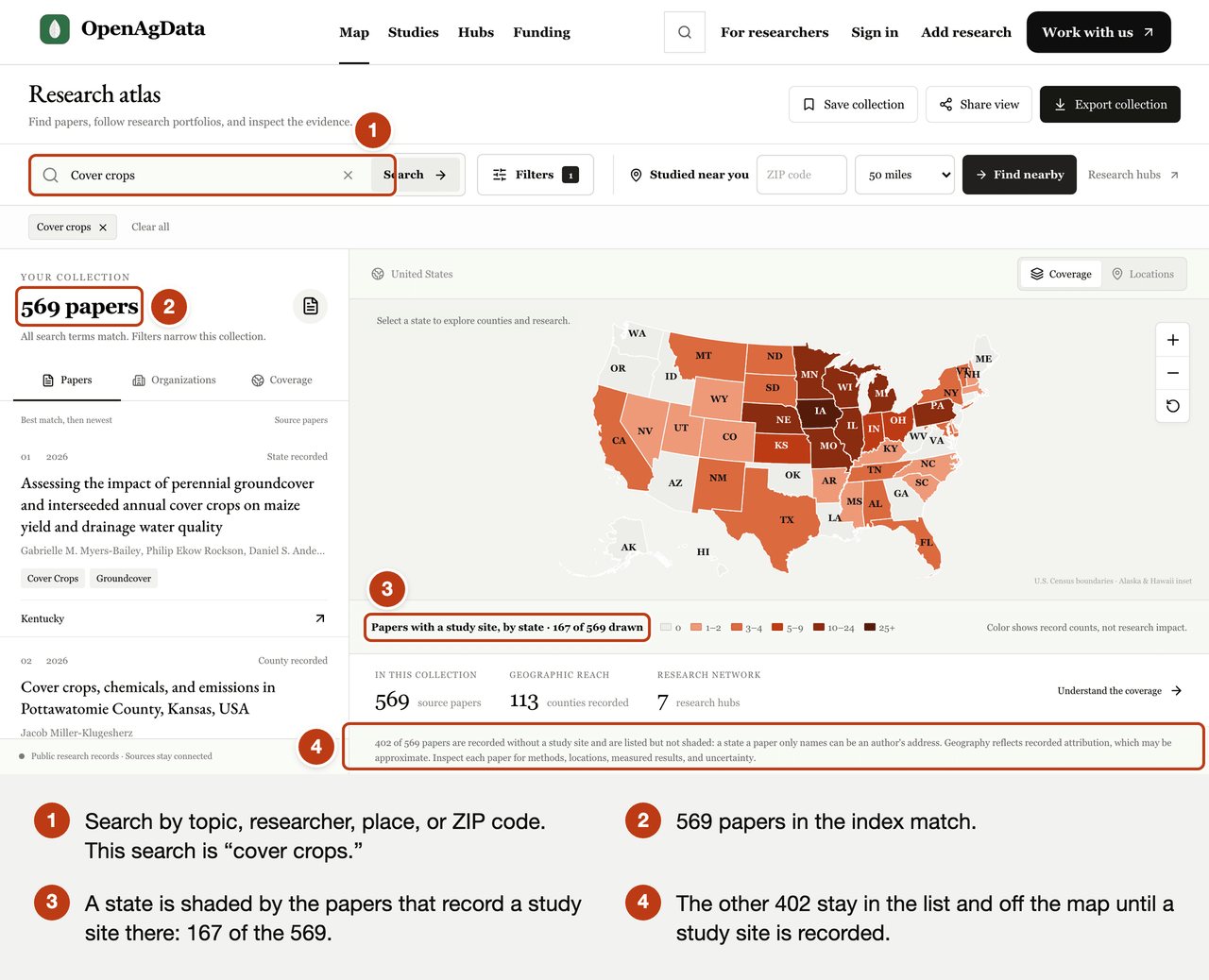
The research atlas searches by topic, researcher, place, or ZIP code. A search for cover crops returns 569 papers, and the map shades each state by how many of them record a study site there.
Read the line under the map before the colors. Of the 569 papers, 167 carry a recorded study site. The other 402 stay in the list and off the map, because a state named in a paper can be the author's address and not the field. The atlas draws what the record supports and says how much that is.
Go from the state to the county
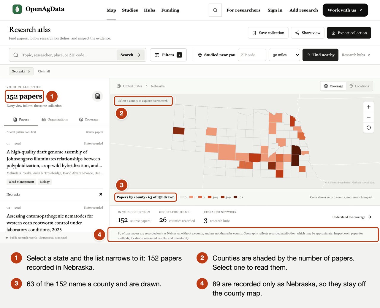
Select a state, and the list and the map narrow to it. Nebraska holds 152 papers. Of these, 63 name a county and are drawn, and 89 are recorded only as Nebraska. Each county is shaded by its number of papers, and selecting one opens the list for that county.
Ask what was studied near you
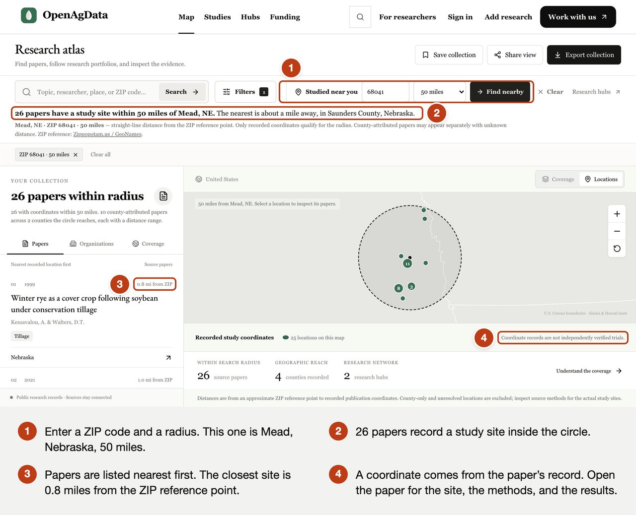
Studied near you takes a ZIP code and a radius. Around Mead, Nebraska, where the University of Nebraska runs a research center, 26 papers record a study site within 50 miles. They are listed nearest first, starting with a 1999 study of winter rye as a cover crop after soybean, 0.8 miles from the ZIP reference point.
Distance is a straight line from the center of the ZIP code to the coordinates in the paper's record. It gets you to the right papers. The paper gives the site, the soil, and the methods.
Follow one organization's research
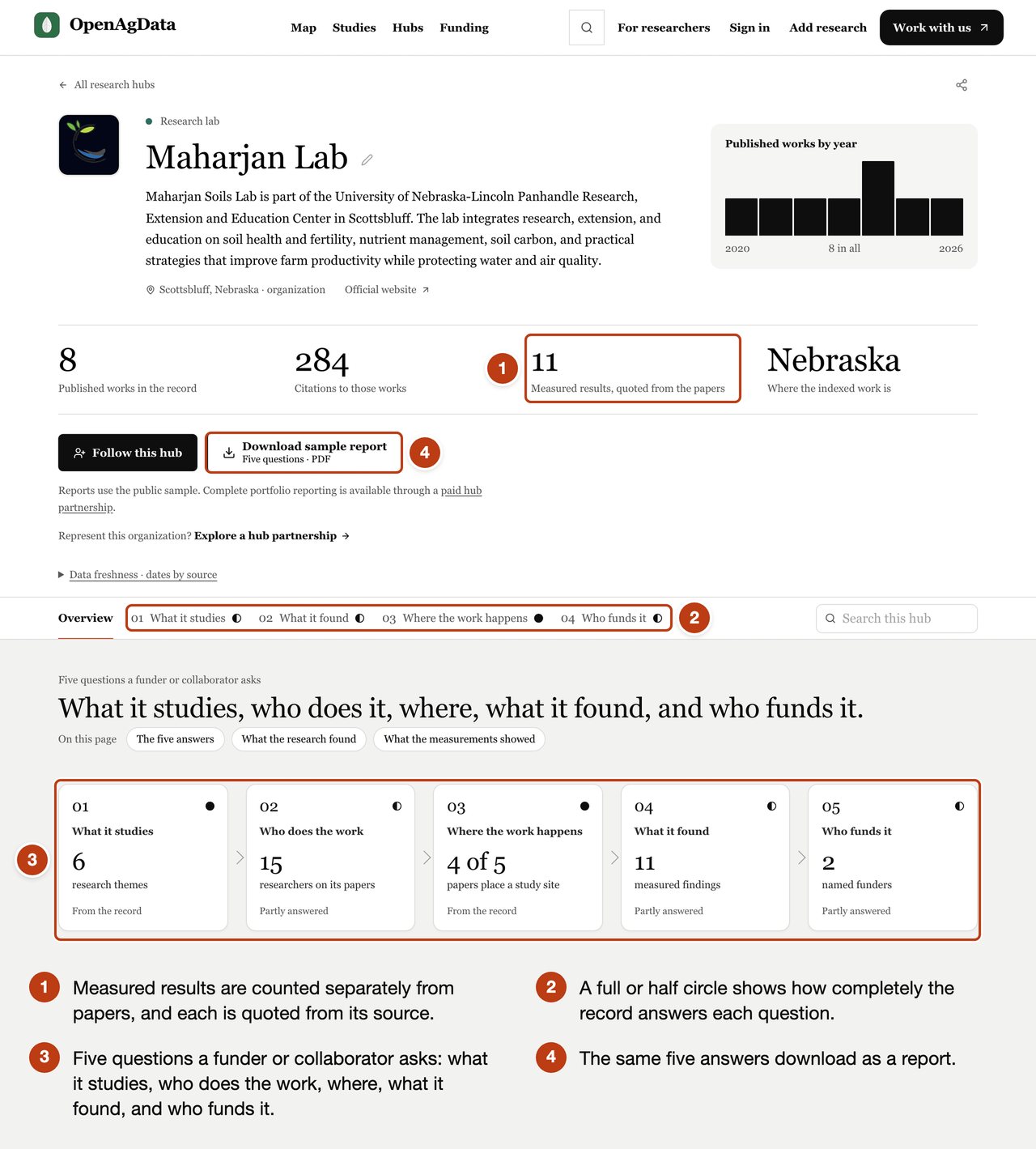
A research hub gathers the work of one organization: a lab, a research institute, a commodity board, or a grant program. Eight are public today. Each is built around five questions a funder or a collaborator asks: what it studies, who does the work, where, what it found, and who funds it.
The hub shown here is the Maharjan Soils Lab, at the University of Nebraska–Lincoln's Panhandle Research, Extension and Education Center in Scottsbluff. Its record holds 8 published works, 15 researchers, and 11 measured results. A full or half circle beside each question shows how completely the record answers it, so a gap reads as a gap.
Read what was measured
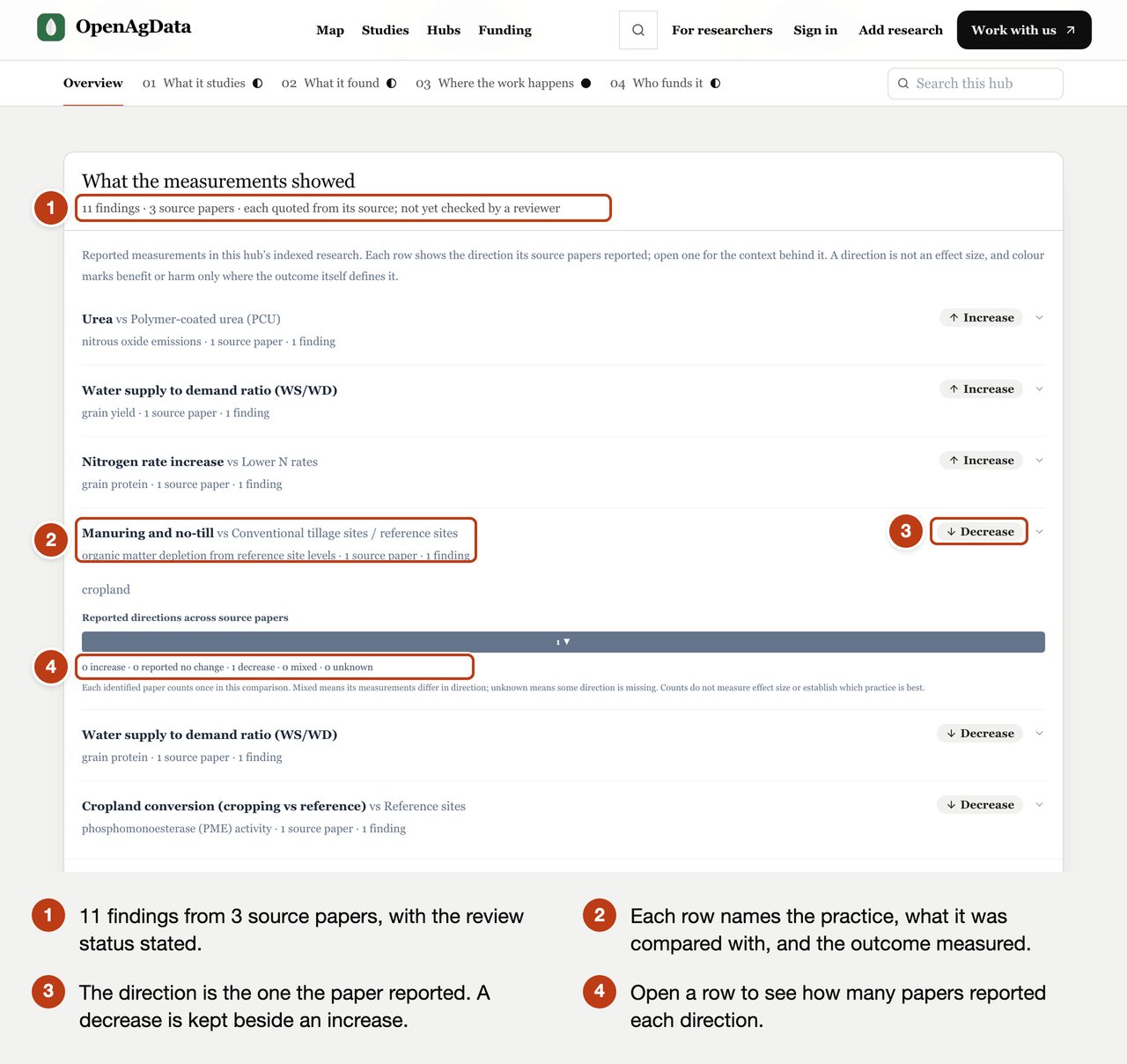
Under the five questions, the hub lists measurements taken from the papers. Each row names the practice, what it was compared with, the outcome measured, and the direction the paper reported.
The direction describes the measurement. Whether it is good news depends on the outcome. In the open row, cropland under manuring and no-till lost less soil organic matter, measured against reference sites, than cropland under continued conventional tillage. The direction reads Decrease, and a decrease in depletion is the better result. Three rows up, urea compared with polymer-coated urea reads Increase for nitrous oxide emissions. The table keeps every direction a paper reports: increase, decrease, no change, and mixed.
The header states where the findings stand: these 11 are quoted from 3 source papers and have not yet been checked by a reviewer. Papers and findings are counted separately, because one experiment can produce several papers.
Find the funding for the next study
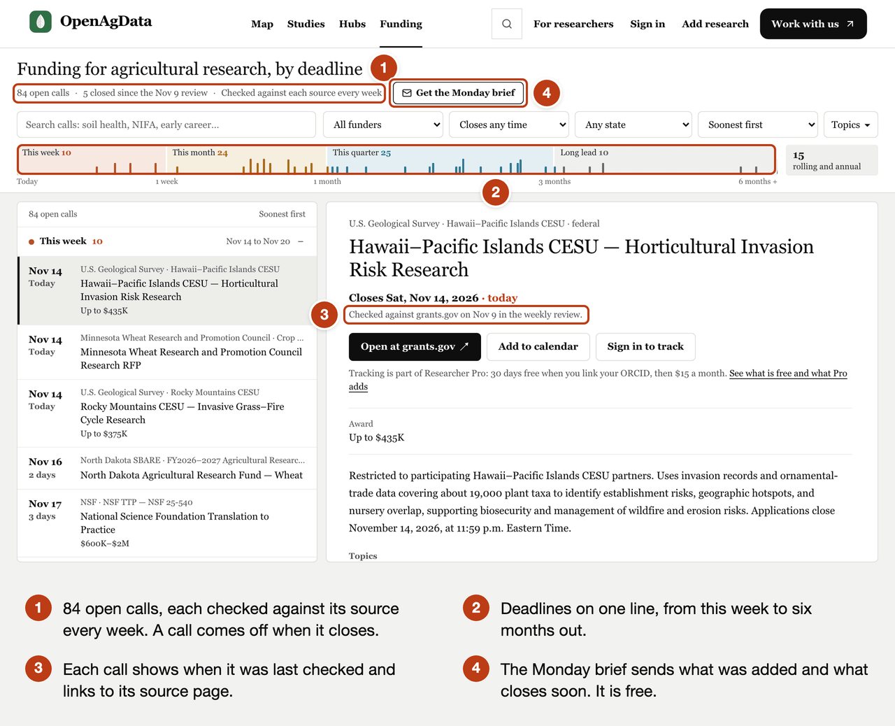
The funding board lists open calls for agricultural research by deadline, from federal programs, state and university programs, foundations, and commodity boards. It held 84 open calls on November 14, 2026. Every call is checked against its source each week and comes off the list when it closes.
The strip across the top puts every deadline on one line, from this week to six months out. Each call shows the date it was last checked and links to its source page. The Monday brief sends the week's changes by email: what was added and what closes soon. It is free.
For researchers, a record of your own
Researchers can keep a free record in the researcher workspace. Link an ORCID iD and your paper list is on your record, along with the funders your papers acknowledge, the places you studied, and the people you published with, all read from the papers themselves. The same record ranks the funding board against your topics and your state. Researcher Pro adds deadline tracking and a collaboration map for $15 a month, and it is free for 30 days when you link an ORCID iD.
How it reaches Soil Health Exchange
OpenAgData is the research layer under the other platforms we build. In FieldLog, a farmer writing a question to an expert can look up measured field-trial results for their county before sending it. That lookup reads from OpenAgData.
For the experts who answer questions on the Knowledge Hub, the atlas shows whether a practice has been tested near the person asking, and which study to cite when it has.
Where OpenAgData is headed
Two jobs set the pace. The first is placing more papers. Of the 1,937 papers in the public index, 614 carry a study site today, and each new one comes from reading a methods section. The second is review: a person checks each measured finding against the paper it came from, and the "not yet checked" label comes off one finding at a time.
Finding research on OpenAgData is free. Organizations that want their full portfolio kept up as a hub work with us as paid partners.
Start with your own ZIP code
Open the research atlas, enter your ZIP code under Studied near you, and read the nearest paper. If a study you know is missing, add it. If one sits in the wrong county, tell us. People who know the ground make the map more accurate.
If you fund or run research and want to see your own portfolio this way, start a conversation with us. We begin by learning what your organization needs to show, and to whom.